 AVYCAST
Aoraki/Mt Cook — Lawinenlagebericht
Die Lawinengefahr in Aoraki/Mt Cook (Neuseeland) ist 2 — Mäßig, gültig für Montag, 12. Oktober 2026. Veröffentlicht von New Zealand Avalanche Advisory.
Übersetzung läuft — Anzeige in Originalsprache
With a mixture of some new snow up high and rain on snow down low, we're back to a more cautious approach. Take the time to check out any new to old bond and beware of saturated sloppy snow at lower elevations.
Gefahr nach Höhenlage
Aktive Lawinenprobleme

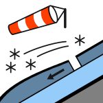
Multiple Loose Wet avalanches observed from last weeks storm cycle. Nothing new reported over the last 72hrs. Conditions not allowing many observations Saturday PM Showers, easing in the afternoon, clearing in the evening. Snow to 1900 metres at first. Northerly gale 80 km/h, easing to northwest 50 km/h by midday, becoming light in the evening.Freezing level 2300 metres, lifting above 3000 metres in the afternoon. Near ridgelines there have been strong winds and firm conditions. Expect wind scoured slopes and bullet proof snow on northern and north western. If you're heading into the high alpine take an ice axe and crampons.
The snow pack existing a week or so back consisted of a multi layered sandwhich of crusts and moist grains which had mostly settled out, with some cold snow on high shady elevations from a mid month storm. The 26th -27 brought 55mm rain at 1800m at Mueller hut. Snow above 2000m at first then to valley floor. 2nd-3rd Oct had 5-10cm new snow above 2100, Pretty much settled, Wednesday saw 15-20cm new snow above 2000m and a few cm's later in the week, mostly settled out. 5-15cm expected over Saturday Sunday above 2000m Below 2100m most of the snow is moist to saturated.
Quelle: New Zealand Avalanche Advisory · Original-Lagebericht ansehen
Original (EN)
Häufige Fragen
Was bedeutet Lawinengefahrenstufe 2 (Mäßig)?
Erhöhte Lawinengefahr an einigen Steilhängen — sorgfältige Routenwahl und Geländebeurteilung sind nötig.
Wie oft wird der Lagebericht für Aoraki/Mt Cook aktualisiert?
Avycast aktualisiert stündlich; New Zealand Avalanche Advisory veröffentlicht den Lagebericht in der Saison meist einmal täglich neu.
Wer veröffentlicht den Lawinenlagebericht für Aoraki/Mt Cook?
New Zealand Avalanche Advisory — der offizielle Lawinenwarndienst. Avycast bündelt und übersetzt ihn; prüfe immer den Originalbericht.
Regionen in der Nähe
- Two Thumbs · 45 km
- Ohau · 77 km
- Mt Hutt · 113 km
- Craigieburn Range · 128 km
- Arthur's Pass · 136 km
- Aspiring · 147 km