 AVYCAST
Aoraki/Mt Cook — Лавинный прогноз
Лавинная опасность в регионе Aoraki/Mt Cook (Новая Зеландия) — 2, Умеренный, действует на понедельник, 12 октября 2026 г.. Публикует New Zealand Avalanche Advisory.
Смешение нового снега в верхней части и дождя на снежном покрове в нижних районах возвращает нас к более осторожному подходу. Потратьте время на проверку любых новых и старых связей и будьте осторожны с насыщенным рыхлым снегом на низких высотах.
Опасность по высоте
Активные лавинные проблемы

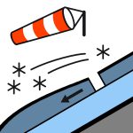
Зафиксировано несколько лавин типа «вумф» (звук оседания) из-за слабых слоёв, вызванных прошлой неделей снегопада. Ничего нового не сообщается за последние 72 часа. Условия не позволяют проводить многочисленные наблюдения в субботу после обеда. Осадки, ослабевающие к вечеру, прояснение в течение вечера. Снег до 1900 метров вначале. Северный штормовой ветер 80 км/ч, ослабевает до северо-западного 50 км/ч к полдню, к вечеру становится слабым. Уровень морозов 2300 метров, поднимается выше 3000 метров к полдню. Вблизи границ леса наблюдались сильные ветры и твёрдые условия. Ожидайте ветровых досок и снегопадных досок на северных и северо-западных склонах. Если вы направляетесь в высокогорье, возьмите ледоруб и кошки.
Снежный покров, существовавший примерно неделю назад, состоял из многослойного «сэндвича» из корок и влажных зерен, которые в основном осели, с некоторым холодным снегом на высоких тенистых участках после середины месяца снегопада. 26-27 числа выпало 55 мм дождя на высоте 1800 м у хижины Мюллера. Снег выше 2000 м сначала, затем до долины. 2-3 октября выпало 5-10 см нового снега выше 2100 м. В основном всё осело, в среду выпало 15-20 см нового снега выше 2000 м, и несколько сантиметров позже на неделе, в основном осели. Ожидается 5-15 см снега в субботу и воскресенье выше 2000 м. Ниже 2100 м большая часть снега влажная или насыщенная.
Источник: New Zealand Avalanche Advisory · Открыть оригинал
Переведено (EN)
Частые вопросы
Что означает уровень лавинной опасности 2 (Умеренный)?
Повышенная лавинная опасность на отдельных крутых склонах — нужны аккуратный выбор маршрута и оценка рельефа.
Как часто обновляется прогноз для региона Aoraki/Mt Cook?
Avycast обновляет данные ежечасно; New Zealand Avalanche Advisory переиздаёт бюллетень обычно раз в день в течение сезона.
Кто публикует лавинный прогноз для региона Aoraki/Mt Cook?
New Zealand Avalanche Advisory — официальная лавинная служба. Avycast агрегирует и переводит его; всегда сверяйтесь с оригинальным бюллетенем.
Регионы рядом
- Two Thumbs · 45 km
- Ohau · 77 km
- Mt Hutt · 113 km
- Craigieburn Range · 128 km
- Arthur's Pass · 136 km
- Aspiring · 147 km