 AVYCAST
Fiordland — Boletín de aludes
El peligro de aludes en Fiordland (Nueva Zelanda) es 2 — Limitado, válido para lunes, 12 de octubre de 2026. Publicado por New Zealand Avalanche Advisory.
Después de varios días cálidos, el manto nivoso se ha derretido visiblemente en casi todas las elevaciones. El manto nivoso continuará derritiéndose el domingo con una capa de nieve ligera por la mañana hasta aproximadamente 2100 m y lluvia por debajo de esa altitud, seguida de sol y un aumento del nivel de congelación hasta aproximadamente 3000 m en la tarde. Tenga precaución con las pendientes muy empinadas y soleadas que recibirán la radiación solar completa en medio del día. Diríjase a lugares más planos o frescos si la nieve comienza a deslizarse. Es posible avalanchas de placas de viento en la lluvia, por lo que debe mantenerse alejado de áreas con deformaciones.
Peligro por cota
Problemas de aludes activos

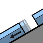
Viernes 2 de octubre - observación pública en la zona de Homer, actividad natural generalizada en lluvia cálida. El nivel de congelación estaba alrededor de 2300 m. Lunes 28 de septiembre - Algunas evidencias de actividad durante la tormenta del lunes 27. Pompolona descendió casi hasta el fondo del valle, probablemente de tamaño 3-4. El nivel de congelación estaba alrededor de 2000 m. Pronóstico del Parque Nacional Fiordland para el domingo 11 de octubre de 2026. Chubascos, despejando en la tarde pero permaneciendo nublado con lluvias ocasionales al sur de la Isla del Secretario. Nieve hasta 2100 metros en el norte al principio. Viento a 1000 metros - Vendaval del norte de 85 km/h en los fiordos, pero vendaval de 65 km/h en otros lugares, disminuyendo a noroeste de 30 km/h al norte de la Isla del Secretario en la tarde, y a noroeste de 30 km/h en todas partes en la noche. Viento a 2000 metros - Vendaval del norte de 80 km/h, girando a oeste de 50 km/h en la tarde, y ligero en la noche. Nivel de congelación - 2500 metros, elevándose por encima de 3000 metros en la tarde. Emitido: 11:55 a.m. sábado 10 de octubre. Lleve un piolet y crampones si sale a explorar.
8 al 10 de octubre - los niveles de congelación han estado por encima de 2000 m durante varios días, con solo un pequeño enfriamiento nocturno. Ha habido un derretimiento visible generalizado. 7 de octubre - lluvia y niveles de congelación de regreso a aproximadamente 2500 m. Espere un manto nivoso en proceso de derretimiento. 6 de octubre - La mayor parte de la nieve en Fiordland estará congelada después de 2 días con el nivel de congelación cercano a la línea de nieve y vientos fuertes. 2 de octubre - hasta aproximadamente 50 mm de lluvia sobre el manto nivoso por debajo de 2200 m. Casi todo el manto nivoso en Fiordland está atravesando un ciclo de derretimiento y congelación. 28 de septiembre - nieve hasta aproximadamente 1400 m, lluvia por debajo de esa altitud. Espere placas de viento en las elevaciones altas y algo de actividad de nieve suelta en las elevaciones medias. 27 de septiembre - nieve hasta aproximadamente 400 m con vientos fuertes del suroeste. 25 de septiembre - nieve hasta unos 1900 m, lluvia por debajo de esa altitud. 22 de septiembre - aproximadamente 5 cm de nieve hasta 1100 m y viento fuerte del oeste. 21 de septiembre - aproximadamente 50 mm de lluvia en 2100/2200 m y por debajo, la mayor parte en 4 a 5 horas.
Fuente: New Zealand Avalanche Advisory · Ver boletín original
Traducido (EN)
Preguntas frecuentes
¿Qué significa el nivel de peligro de aludes 2 (Limitado)?
Peligro elevado en algunas laderas empinadas — se requiere una elección de itinerario y una evaluación del terreno cuidadosas.
¿Con qué frecuencia se actualiza el boletín de Fiordland?
Avycast se actualiza cada hora; New Zealand Avalanche Advisory vuelve a publicar el boletín normalmente una vez al día durante la temporada.
¿Quién publica el boletín de aludes de Fiordland?
New Zealand Avalanche Advisory — el servicio oficial de alerta. Avycast lo agrega y lo traduce; consulta siempre el boletín original.
Regiones cercanas
- Queenstown · 91 km
- Wanaka · 98 km
- Aspiring · 108 km
- Ohau · 188 km
- Aoraki/Mt Cook · 253 km
- Two Thumbs · 274 km