 AVYCAST
Fiordland — Lawinenlagebericht
Die Lawinengefahr in Fiordland (Neuseeland) ist 2 — Mäßig, gültig für Montag, 12. Oktober 2026. Veröffentlicht von New Zealand Avalanche Advisory.
Übersetzung läuft — Anzeige in Originalsprache
After several warm days the snowpack has visibly melted at almost all elevations. The snowpack will continue to melt on Sunday with a morning skiff of snow down to about 2100m and rain below that, followed by sun and a freezing level rise to about 3000m in the afternoon. Be cautious of very steep sunny slopes that will catch the full brunt of the sun in the middle of the day, Go somewhere flatter or cooler if the snow starts sluffing Glide slab avalanches are possible in the rain so continue to stay well away from any buckled areas.
Gefahr nach Höhenlage
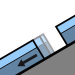
Aktive Lawinenprobleme

Fri 2nd October- public observation from Homer area, widespread natural activity in warm rain. Freezing level was about 2300m Mon 28th Sept - Some evidence of activity over the storm on Mon 27th. Pompolona ran to almost valley floor, sz 3-4 probably. Freezing level was about 2000m Fiordland National Park Forecast for Sunday 11th October 2026Showers, clearing in the afternoon but remaining cloudy with the odd shower lingering south of Secretary Island. Snow to 2100 metres in the north at first.Wind at 1000 metres - Northerly gale 85 km/h about the Fiords but gale 65 km/h elsewhere, easing to northwesterly 30 km/h north of Secretary Island in the afternoon, becoming northwest 30 km/h everywhere in the evening.Wind at 2000 metres - Northerly gale 80 km/h, turning westerly 50 km/h in the afternoon, becoming light at night.Freezing level - 2500 metres, lifting above 3000 metres in the afternoon.Issued: 11:55am Sat 10 Oct Take an ice axe and crampons if you are out exploring-
8th -10th October - freezing levels have been above 2000m for several days with only a small amount of cooling at night. There has been widespread visible melt going on. 7-October Rain and freezing levels back up to around 2500m. Expect a wet melting snowpack 6 October - Most snow in Fiordland will be frozen after 2 days of the freezing level being close to the snowline and strong winds. 2nd October- up to about 50mm rain on the snowpack below 2200m. Almost all of the Fiordland snowpack is now going through a melt and freeze cycle. 28th Sept- Snow down to around 1400m, rain below that. Expect continued slab at high elevations and some loose snow activity at the mid elevations. 27th Sept - Snow down to around 400m with strong SW winds. 25th Sept- Snow down to about 1900m, rain below that. 22nd - About 5cm of snow down to 1100m, and strong W wind 21st Sept - About 50mm of rain 2100/2200m and below, most fell in 4 - 5 hours.
Quelle: New Zealand Avalanche Advisory · Original-Lagebericht ansehen
Original (EN)
Häufige Fragen
Was bedeutet Lawinengefahrenstufe 2 (Mäßig)?
Erhöhte Lawinengefahr an einigen Steilhängen — sorgfältige Routenwahl und Geländebeurteilung sind nötig.
Wie oft wird der Lagebericht für Fiordland aktualisiert?
Avycast aktualisiert stündlich; New Zealand Avalanche Advisory veröffentlicht den Lagebericht in der Saison meist einmal täglich neu.
Wer veröffentlicht den Lawinenlagebericht für Fiordland?
New Zealand Avalanche Advisory — der offizielle Lawinenwarndienst. Avycast bündelt und übersetzt ihn; prüfe immer den Originalbericht.
Regionen in der Nähe
- Queenstown · 91 km
- Wanaka · 98 km
- Aspiring · 108 km
- Ohau · 188 km
- Aoraki/Mt Cook · 253 km
- Two Thumbs · 274 km