 AVYCAST
Wanaka — Lawinenlagebericht
Die Lawinengefahr in Wanaka (Neuseeland) ist 2 — Mäßig, gültig für Sonntag, 11. Oktober 2026. Veröffentlicht von New Zealand Avalanche Advisory.
Übersetzung läuft — Anzeige in Originalsprache
Showers, warm temperatures and an elevated freezing level (2600m rising to 3000m). Expect a moist soft snowpack underneath a shallow surface freeze. Wet slide activity (Loose Wet and Glide) is possible. These slides are most likely to occur on North facing slopes but may also occur on other aspects. Watch for signs of growing instability such as point releases and rafting.
Gefahr nach Höhenlage
Aktive Lawinenprobleme

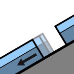
No avalanche activity reported recently. If you see evidence of avalanches in the back country please enter a Public Observation. Sunday - mostly fine with perhaps the odd shower. Strong North/North West winds turning Westerly and easing. Freezing level - 2600m climbing to 3000m in the afternoon. Spring conditions (melt/freeze) generally result in an elevated sliding hazard. Slick crusts and icy areas have been widespread especially, below about 1900m. Recommend carrying ski crampons and/or an ice axe and crampons.
Some rain on snow in the West of the region over the past 48hours. We now have a typical Spring snow pack with a melt/freeze cycle occurring. The underlying snow pack above about 1800m is mostly well settled. The snow pack below about 1800m is likely to be holding a significant amount of moisture underneath a shallow surface freeze.
Quelle: New Zealand Avalanche Advisory · Original-Lagebericht ansehen
Original (EN)
Häufige Fragen
Was bedeutet Lawinengefahrenstufe 2 (Mäßig)?
Erhöhte Lawinengefahr an einigen Steilhängen — sorgfältige Routenwahl und Geländebeurteilung sind nötig.
Wie oft wird der Lagebericht für Wanaka aktualisiert?
Avycast aktualisiert stündlich; New Zealand Avalanche Advisory veröffentlicht den Lagebericht in der Saison meist einmal täglich neu.
Wer veröffentlicht den Lawinenlagebericht für Wanaka?
New Zealand Avalanche Advisory — der offizielle Lawinenwarndienst. Avycast bündelt und übersetzt ihn; prüfe immer den Originalbericht.
Regionen in der Nähe
- Aspiring · 25 km
- Queenstown · 28 km
- Ohau · 90 km
- Fiordland · 98 km
- Aoraki/Mt Cook · 156 km
- Two Thumbs · 176 km