 AVYCAST
Wanaka — Bollettino valanghe
Il pericolo valanghe in Wanaka (Nuova Zelanda) è 2 — Moderato, valido per domenica 11 ottobre 2026. Pubblicato da New Zealand Avalanche Advisory.
Traduzione in corso — mostrato in lingua originale
Showers, warm temperatures and an elevated freezing level (2600m rising to 3000m). Expect a moist soft snowpack underneath a shallow surface freeze. Wet slide activity (Loose Wet and Glide) is possible. These slides are most likely to occur on North facing slopes but may also occur on other aspects. Watch for signs of growing instability such as point releases and rafting.
Pericolo per quota
Problemi valanghivi attivi

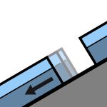
No avalanche activity reported recently. If you see evidence of avalanches in the back country please enter a Public Observation. Sunday - mostly fine with perhaps the odd shower. Strong North/North West winds turning Westerly and easing. Freezing level - 2600m climbing to 3000m in the afternoon. Spring conditions (melt/freeze) generally result in an elevated sliding hazard. Slick crusts and icy areas have been widespread especially, below about 1900m. Recommend carrying ski crampons and/or an ice axe and crampons.
Some rain on snow in the West of the region over the past 48hours. We now have a typical Spring snow pack with a melt/freeze cycle occurring. The underlying snow pack above about 1800m is mostly well settled. The snow pack below about 1800m is likely to be holding a significant amount of moisture underneath a shallow surface freeze.
Fonte: New Zealand Avalanche Advisory · Vedi bollettino originale
Originale (EN)
Domande frequenti
Che cosa significa il grado di pericolo valanghe 2 (Moderato)?
Pericolo accresciuto su alcuni pendii ripidi — servono scelta dell'itinerario e valutazione del terreno accurate.
Con quale frequenza viene aggiornato il bollettino di Wanaka?
Avycast aggiorna ogni ora; New Zealand Avalanche Advisory ripubblica il bollettino di solito una volta al giorno durante la stagione.
Chi pubblica il bollettino valanghe di Wanaka?
New Zealand Avalanche Advisory — il servizio valanghe ufficiale. Avycast lo aggrega e lo traduce; consulta sempre il bollettino originale.
Regioni vicine
- Aspiring · 25 km
- Queenstown · 28 km
- Ohau · 90 km
- Fiordland · 98 km
- Aoraki/Mt Cook · 156 km
- Two Thumbs · 176 km