 AVYCAST
Queenstown — Bollettino valanghe
Il pericolo valanghe in Queenstown (Nuova Zelanda) è 2 — Moderato, valido per domenica 11 ottobre 2026. Pubblicato da New Zealand Avalanche Advisory.
Traduzione in corso — mostrato in lingua originale
High temps continue! Expect wet snow problems in all areas.
Pericolo per quota
Problemi valanghivi attivi

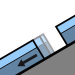
Recent reports of loose wet avalanches in steep South facing terrain. Although small, they were very easily triggered. Moderate westerlies and very warm. FAFL 3000m. Avoid shady aspects first thing unless prepared with the appropriate equipment.
Summer like heat is making its way into all aspects and elevations at the moment. Even normally shady areas - South aspects at upper elevations - are becoming wet in the afternoons. Expect a crust in the morning that will break down quickly in all areas.
Fonte: New Zealand Avalanche Advisory · Vedi bollettino originale
Originale (EN)
Domande frequenti
Che cosa significa il grado di pericolo valanghe 2 (Moderato)?
Pericolo accresciuto su alcuni pendii ripidi — servono scelta dell'itinerario e valutazione del terreno accurate.
Con quale frequenza viene aggiornato il bollettino di Queenstown?
Avycast aggiorna ogni ora; New Zealand Avalanche Advisory ripubblica il bollettino di solito una volta al giorno durante la stagione.
Chi pubblica il bollettino valanghe di Queenstown?
New Zealand Avalanche Advisory — il servizio valanghe ufficiale. Avycast lo aggrega e lo traduce; consulta sempre il bollettino originale.
Regioni vicine
- Wanaka · 28 km
- Aspiring · 53 km
- Fiordland · 91 km
- Ohau · 101 km
- Aoraki/Mt Cook · 173 km
- Two Thumbs · 188 km