 AVYCAST
Queenstown — Лавинный прогноз
Лавинная опасность в регионе Queenstown (Новая Зеландия) — 2, Умеренный, действует на воскресенье, 11 октября 2026 г.. Публикует New Zealand Avalanche Advisory.
Перевод выполняется — показан язык оригинала
High temps continue! Expect wet snow problems in all areas.
Опасность по высоте
Активные лавинные проблемы

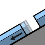
Recent reports of loose wet avalanches in steep South facing terrain. Although small, they were very easily triggered. Moderate westerlies and very warm. FAFL 3000m. Avoid shady aspects first thing unless prepared with the appropriate equipment.
Summer like heat is making its way into all aspects and elevations at the moment. Even normally shady areas - South aspects at upper elevations - are becoming wet in the afternoons. Expect a crust in the morning that will break down quickly in all areas.
Источник: New Zealand Avalanche Advisory · Открыть оригинал
Оригинал (EN)
Частые вопросы
Что означает уровень лавинной опасности 2 (Умеренный)?
Повышенная лавинная опасность на отдельных крутых склонах — нужны аккуратный выбор маршрута и оценка рельефа.
Как часто обновляется прогноз для региона Queenstown?
Avycast обновляет данные ежечасно; New Zealand Avalanche Advisory переиздаёт бюллетень обычно раз в день в течение сезона.
Кто публикует лавинный прогноз для региона Queenstown?
New Zealand Avalanche Advisory — официальная лавинная служба. Avycast агрегирует и переводит его; всегда сверяйтесь с оригинальным бюллетенем.
Регионы рядом
- Wanaka · 28 km
- Aspiring · 53 km
- Fiordland · 91 km
- Ohau · 101 km
- Aoraki/Mt Cook · 173 km
- Two Thumbs · 188 km