 AVYCAST
Wanaka — Лавинный прогноз
Лавинная опасность в регионе Wanaka (Новая Зеландия) — 2, Умеренный, действует на воскресенье, 11 октября 2026 г.. Публикует New Zealand Avalanche Advisory.
Перевод выполняется — показан язык оригинала
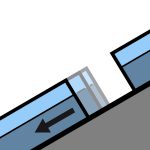
Showers, warm temperatures and an elevated freezing level (2600m rising to 3000m). Expect a moist soft snowpack underneath a shallow surface freeze. Wet slide activity (Loose Wet and Glide) is possible. These slides are most likely to occur on North facing slopes but may also occur on other aspects. Watch for signs of growing instability such as point releases and rafting.
Опасность по высоте
Активные лавинные проблемы

No avalanche activity reported recently. If you see evidence of avalanches in the back country please enter a Public Observation. Sunday - mostly fine with perhaps the odd shower. Strong North/North West winds turning Westerly and easing. Freezing level - 2600m climbing to 3000m in the afternoon. Spring conditions (melt/freeze) generally result in an elevated sliding hazard. Slick crusts and icy areas have been widespread especially, below about 1900m. Recommend carrying ski crampons and/or an ice axe and crampons.
Some rain on snow in the West of the region over the past 48hours. We now have a typical Spring snow pack with a melt/freeze cycle occurring. The underlying snow pack above about 1800m is mostly well settled. The snow pack below about 1800m is likely to be holding a significant amount of moisture underneath a shallow surface freeze.
Источник: New Zealand Avalanche Advisory · Открыть оригинал
Оригинал (EN)
Частые вопросы
Что означает уровень лавинной опасности 2 (Умеренный)?
Повышенная лавинная опасность на отдельных крутых склонах — нужны аккуратный выбор маршрута и оценка рельефа.
Как часто обновляется прогноз для региона Wanaka?
Avycast обновляет данные ежечасно; New Zealand Avalanche Advisory переиздаёт бюллетень обычно раз в день в течение сезона.
Кто публикует лавинный прогноз для региона Wanaka?
New Zealand Avalanche Advisory — официальная лавинная служба. Avycast агрегирует и переводит его; всегда сверяйтесь с оригинальным бюллетенем.
Регионы рядом
- Aspiring · 25 km
- Queenstown · 28 km
- Ohau · 90 km
- Fiordland · 98 km
- Aoraki/Mt Cook · 156 km
- Two Thumbs · 176 km