 AVYCAST
Aspiring — Bulletin d'avalanche
Le danger d'avalanche en Aspiring (Nouvelle-Zélande) est 2 — Limité, valable pour lundi 12 octobre 2026. Publié par New Zealand Avalanche Advisory.
Traduction en cours — affiché en langue source
Plan your trip accordingly to avoid or minimise travel in areas exposed to the following problems. Today is forecast to be warm, with light rain increasing the potential for these problems to occur Areas like the Cascade Saddle and the traverse from Brewster Hut to the Brewster Glacier and Bevan Col may be particularly vulnerable to these problems.
Danger par altitude
Problèmes d'avalanches actifs

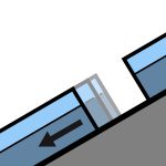
Glide cracks are opening up mostly on north aspects, with some on southeast and southwest aspects too, and some of these are failing to ground. A small size 1 loose wet avalanche was skier-triggered in the Isobel Glacier on a northeast aspect around 1800m on Friday. If you see any recent avalanche occurrences or have any relevant snowpack information or photos, you can share them via the Public Observations link on the NZAA home page. Mt Aspiring National Park ForecastShowers, clearing in the afternoon, but some cloud remaining about the tops.Wind at 1000 metres Northerly 55 km/h, easing to northwesterly 35 km/h late morning, dying out late afternoon.Wind at 2000 metres Gale northerly 70 km/h, easing to northwesterly 45 km/h late morning. Changing southwesterly 35 km/h in the evening, dying out late evening.Wind at 3000 metres Gale northerly 70 km/h, easing to northwesterly 45 km/h before dawn. Turning southwesterly 45 km/h around midday, dying out late evening.Freezing level 2400 metres, lifting to 3100 metres in the morning.Issued: 6:36am Sun 11 Oct At this time of year slick melt-freeze conditions will be likely on most aspects until surface conditions soften by mid to late morning. Depending on your objective, an ice axe and crampons may be necessary in the current conditions.
Only steeper south aspects above around 2500m still have some winter snow structure that appears mostly well consolidated. On all other aspects and elevations, a spring snowpack now exists, with conditions firm and icy in the mornings and turning isothermic, wet and unsupportive, during the warmer hours of the day. Other hazards like large cornices and ice falls will become more prone to collapsing during warmer days. The current snowline is about 1500m on south aspects, 1700m on east and west aspects.
Source: New Zealand Avalanche Advisory · Voir le bulletin d'origine
Original (EN)
Questions fréquentes
Que signifie le niveau de danger d'avalanche 2 (Limité) ?
Danger accru sur certaines pentes raides — un choix d'itinéraire et une évaluation du terrain attentifs sont nécessaires.
À quelle fréquence le bulletin de Aspiring est-il mis à jour ?
Avycast actualise toutes les heures ; New Zealand Avalanche Advisory republie le bulletin généralement une fois par jour pendant la saison.
Qui publie le bulletin d'avalanche de Aspiring ?
New Zealand Avalanche Advisory — le service d'alerte officiel. Avycast l'agrège et le traduit ; consultez toujours le bulletin original.
Régions à proximité
- Wanaka · 25 km
- Queenstown · 53 km
- Ohau · 90 km
- Fiordland · 108 km
- Aoraki/Mt Cook · 147 km
- Two Thumbs · 173 km