 AVYCAST
Nelson Lakes — Avalanche Forecast
Avalanche danger in Nelson Lakes (New Zealand) is 2 — Moderate, valid for Sunday, October 11, 2026. Published by New Zealand Avalanche Advisory.
Loose wet avalanche danger may be possible as rain at most elevations begins to wet the snowpack. Small and isolated wind slab may develop above 2000m.
Danger by Elevation
Active Avalanche Problems

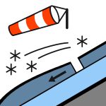
Some recent loose, wet avalanche activity on north-facing aspects up to size 1.5. Please provide any snowpack or avalanche observations using the link below. https://www.avalanche.net.nz/observations Rain has started to fall at all elevations in the park. Sunday will see rain continue, and the freezing level will drop to 2400m so rain may turn to snow at the very top of the big mountains in the park. Wind will be gale-force northwest winds. The freezing level will be 2400m by Sunday morning and rise again during the day to 3000m. The snow will be soft.
Snow cover above 1800m is reasonably consistent, and patchy below. The freezing level has been around 3000m for most of this week. The majority of the snowpack is now a spring snowpack that has been freezing at night and softening by late morning. This has increased loose wet avalanche danger on sunny aspects and caused significant snow loss at low elevations. ]
Source: New Zealand Avalanche Advisory · View Original Bulletin
Original (EN)
Frequently asked questions
What does avalanche danger level 2 (Moderate) mean?
Heightened avalanche conditions on some steep slopes — careful route selection and terrain evaluation are needed.
How often is the Nelson Lakes forecast updated?
Avycast refreshes hourly; the bulletin is republished by New Zealand Avalanche Advisory usually once a day during the season.
Who publishes the Nelson Lakes avalanche forecast?
New Zealand Avalanche Advisory — the official warning service. Avycast aggregates and translates it; always check the original bulletin.
Nearby Regions
- Arthur's Pass · 142 km
- Craigieburn Range · 162 km
- Mt Hutt · 192 km
- Two Thumbs · 260 km
- Aoraki/Mt Cook · 276 km
- Taranaki · 314 km