 AVYCAST
Nelson Lakes — Bulletin d'avalanche
Le danger d'avalanche en Nelson Lakes (Nouvelle-Zélande) est 2 — Limité, valable pour dimanche 11 octobre 2026. Publié par New Zealand Avalanche Advisory.
Traduction en cours — affiché en langue source
Loose wet avalanche danger may be possible as rain at most elevations begins to wet the snowpack. Small and isolated wind slab may develop above 2000m.
Danger par altitude
Problèmes d'avalanches actifs

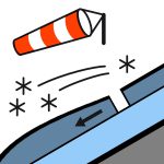
Some recent loose, wet avalanche activity on north-facing aspects up to size 1.5. Please provide any snowpack or avalanche observations using the link below. https://www.avalanche.net.nz/observations Rain has started to fall at all elevations in the park. Sunday will see rain continue, and the freezing level will drop to 2400m so rain may turn to snow at the very top of the big mountains in the park. Wind will be gale-force northwest winds. The freezing level will be 2400m by Sunday morning and rise again during the day to 3000m. The snow will be soft.
Snow cover above 1800m is reasonably consistent, and patchy below. The freezing level has been around 3000m for most of this week. The majority of the snowpack is now a spring snowpack that has been freezing at night and softening by late morning. This has increased loose wet avalanche danger on sunny aspects and caused significant snow loss at low elevations. ]
Source: New Zealand Avalanche Advisory · Voir le bulletin d'origine
Original (EN)
Questions fréquentes
Que signifie le niveau de danger d'avalanche 2 (Limité) ?
Danger accru sur certaines pentes raides — un choix d'itinéraire et une évaluation du terrain attentifs sont nécessaires.
À quelle fréquence le bulletin de Nelson Lakes est-il mis à jour ?
Avycast actualise toutes les heures ; New Zealand Avalanche Advisory republie le bulletin généralement une fois par jour pendant la saison.
Qui publie le bulletin d'avalanche de Nelson Lakes ?
New Zealand Avalanche Advisory — le service d'alerte officiel. Avycast l'agrège et le traduit ; consultez toujours le bulletin original.
Régions à proximité
- Arthur's Pass · 142 km
- Craigieburn Range · 162 km
- Mt Hutt · 192 km
- Two Thumbs · 260 km
- Aoraki/Mt Cook · 276 km
- Taranaki · 314 km