 AVYCAST
Nelson Lakes — Лавинный прогноз
Лавинная опасность в регионе Nelson Lakes (Новая Зеландия) — 2, Умеренный, действует на воскресенье, 11 октября 2026 г.. Публикует New Zealand Avalanche Advisory.
Возможна опасность возникновения слабых слоёв, связанных с влажностью снега, при начале осадков в виде дождя на большинстве высот, что приводит к увлажнению снежного покрова. Небольшие и изолированные ветровые доски могут образовываться выше 2000 м.
Опасность по высоте
Активные лавинные проблемы

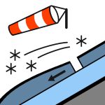
В последнее время наблюдалась некоторая активность слабых слоёв, связанная с влажным снегом, в виде лавин до размера 1,5 на северных склонах. Пожалуйста, сообщайте о наблюдениях за снежным покровом или лавинами, используя следующую ссылку: https://www.avalanche.net.nz/observations Дождь начался на всех высотах в парке. В воскресенье дождь продолжится, а уровень морозов опустится до 2400 м, поэтому в верхней части больших гор в парке дождь может перейти в снег. Ветер будет штормовым, северо-западным. Уровень морозов составит 2400 м к утру воскресенья и повысится в течение дня до 3000 м. Снег будет мягким.
Снежный покров выше 1800 м достаточно равномерный, ниже — разреженный. Уровень морозов оставался около 3000 м большую часть этой недели. Большая часть снежного покрова сейчас представляет собой весенний снежный покров, который замерзает ночью и размягчается к позднему утру. Это увеличило опасность возникновения слабых слоёв, связанных с влажным снегом, на солнечных склонах, а также привело к значительной потере снега на низких высотах.
Источник: New Zealand Avalanche Advisory · Открыть оригинал
Переведено (EN)
Частые вопросы
Что означает уровень лавинной опасности 2 (Умеренный)?
Повышенная лавинная опасность на отдельных крутых склонах — нужны аккуратный выбор маршрута и оценка рельефа.
Как часто обновляется прогноз для региона Nelson Lakes?
Avycast обновляет данные ежечасно; New Zealand Avalanche Advisory переиздаёт бюллетень обычно раз в день в течение сезона.
Кто публикует лавинный прогноз для региона Nelson Lakes?
New Zealand Avalanche Advisory — официальная лавинная служба. Avycast агрегирует и переводит его; всегда сверяйтесь с оригинальным бюллетенем.
Регионы рядом
- Arthur's Pass · 142 km
- Craigieburn Range · 162 km
- Mt Hutt · 192 km
- Two Thumbs · 260 km
- Aoraki/Mt Cook · 276 km
- Taranaki · 314 km