 AVYCAST
Nelson Lakes — Lawinenlagebericht
Die Lawinengefahr in Nelson Lakes (Neuseeland) ist 2 — Mäßig, gültig für Sonntag, 11. Oktober 2026. Veröffentlicht von New Zealand Avalanche Advisory.
Das Risiko für lockere Nasslawinen kann bestehen, da Regen in den meisten Höhenlagen beginnt, den Schneedecken zu durchfeuchten. Kleine und isolierte Triebschneeansammlungen können sich oberhalb von 2000 m entwickeln.
Gefahr nach Höhenlage
Aktive Lawinenprobleme

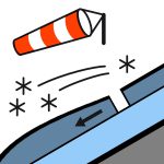
Kürzliche Aktivitäten von lockeren, nassen Lawinen auf Nordhängen bis zur Größe 1,5. Bitte melden Sie jegliche Beobachtungen an Schneedecken oder Lawinen über den untenstehenden Link. https://www.avalanche.net.nz/observations Regen hat in allen Höhenlagen im Park begonnen. Am Sonntag wird Regen andauern, und die Schneefrostgrenze sinkt auf 2400 m, sodass aus Regen auf den höchsten Gipfeln der großen Berge im Park Schnee werden könnte. Der Wind wird stürmischer Nordwestwind sein. Die Frostgrenze liegt am Sonntagmorgen bei 2400 m und steigt im Laufe des Tages wieder auf 3000 m. Der Schnee wird weich sein.
Die Schneedecke oberhalb von 1800 m ist relativ gleichmäßig, darunter unregelmäßig. Die Frostgrenze lag die meiste Zeit dieser Woche bei etwa 3000 m. Der Großteil der Schneedecke ist jetzt eine Frühjahrs-Schneedecke, die nachts gefriert und am späten Vormittag weicher wird. Dies hat die Gefahr von lockeren Nasslawinen an sonnigen Hängen erhöht und zu erheblichen Schneeverlusten in tieferen Lagen geführt.
Quelle: New Zealand Avalanche Advisory · Original-Lagebericht ansehen
Übersetzt (EN)
Häufige Fragen
Was bedeutet Lawinengefahrenstufe 2 (Mäßig)?
Erhöhte Lawinengefahr an einigen Steilhängen — sorgfältige Routenwahl und Geländebeurteilung sind nötig.
Wie oft wird der Lagebericht für Nelson Lakes aktualisiert?
Avycast aktualisiert stündlich; New Zealand Avalanche Advisory veröffentlicht den Lagebericht in der Saison meist einmal täglich neu.
Wer veröffentlicht den Lawinenlagebericht für Nelson Lakes?
New Zealand Avalanche Advisory — der offizielle Lawinenwarndienst. Avycast bündelt und übersetzt ihn; prüfe immer den Originalbericht.
Regionen in der Nähe
- Arthur's Pass · 142 km
- Craigieburn Range · 162 km
- Mt Hutt · 192 km
- Two Thumbs · 260 km
- Aoraki/Mt Cook · 276 km
- Taranaki · 314 km